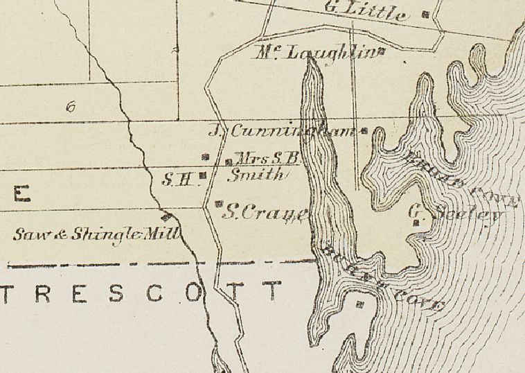
Burnt Cove, Edmunds, Maine, from the Colby Atlas, 1881 (detail)
Map
Detail of map of south Edmunds in 1881, showing the structures and their occupants around Burnt Cove, including the School House, and a Saw and shingle Mill on Crane Mill Brook. Note that the boundary with Trescott was later moved to incorporate the land belonging to the Bell farm and tide mill at the southern end of Crane Mill Brook.


