Lot Map of Township No. 1 and 2, Eastern Maine, c. 1805
Work on Paper
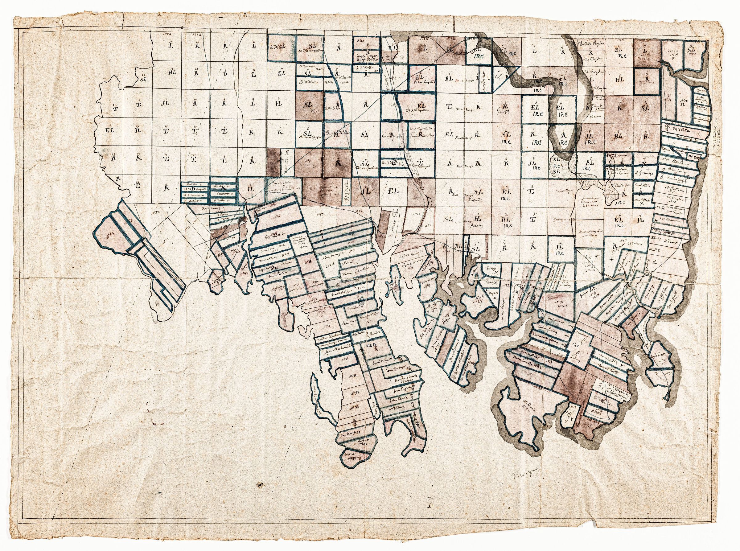
A hand drawn map of Townships No. 1 and 2, later Perry, Pembroke and Dennysville, Maine, showing the property lines and occupants/owners c. 1805.
Dennnys River Map CollectionPhotos for Map